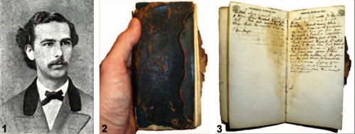
ABSTRACT. The discovery of the 1871 journal of Theodore L. Mead provides an opportunity to establish a more accurate itinerary of his exploration of Colorado that summer. The provenance of Mead’s manuscripts, including this journal, is summarized. The history of Mead’s expedition and the subsequent distribution of his butterfly specimens are reviewed. Despite the general belief that Mead participated in the Wheeler Survey, there is no evidence to support this claim. Information is presented on three significant localities where Mead collected butterfly type specimens: Kenosha House (figured and mapped), Turkey Creek Junction (Bradford Junction; figured and mapped), and Twin Lakes (mapped).
Updated Colorado Itinerary.
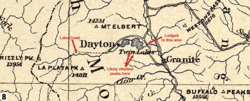
Based upon Mead’s 1871 journal, I offer a corrected itinerary of Mead’s exploration of Colorado. The map included in Brown (1955a) is still a helpful reference to the locations visited by Mead, but some of the dates and estimated routes are incorrect. Three locations where Mead spent a great deal of time in Colorado serve as the type localities for multiple taxa described from his specimens. Kenosha House and Turkey Creek Junction were 19th century stagecoach stops in Park and Jefferson Counties, respectively. The third, Twin Lakes, is located in southern Lake County.
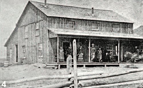
Note: Figure 4 Kenosha House was a stage station at the west side of Kenosha Hill. It was built in the early 1860s and was still operating in the late 1890s. This photo was taken about 1870. Courtesy pf the Library, State Historical Society of Colorado (Bayou Salado: The Story of South Park, by Virginia McConnell Simmons)
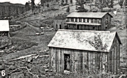
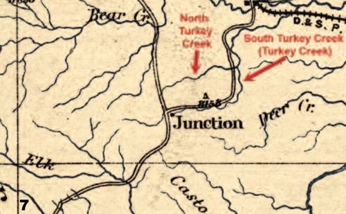
Note: Figure 6 Park County Local History Archives Image 3288. Bradford Junction. Circa 1870s. Duhem Brothers photograph 15 - Stereo View. Credit: Ed & Nancy Bathke Collection. This small settlement and stagecoach stop was established by Robert B. Bradford, who owned the property from 1860 to 1873. (Itinerary of Theodore L. Mead in Colorado in 1871)
Kenosha House. Described by Mead as “a clean well-kept ranch,†Kenosha House was a two-story stagecoach station constructed in 1861 (Fig. 4). Offering meals and lodging to weary travelers, the proprietors advertised “an excellent variety of tempting food,†including venison, wild duck, and mountain strawberries (Anonymous 1870, Crump & Crump 2010). Kenosha House also had mail service, which allowed Mead to send letters to W. H. Edwards and others while lodging there. Mead often referred to the station as “Kenosha Ranch.â€
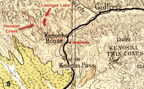
Disagreement exists regarding the location of Kenosha House, with some authors (e.g. Fisher 2006) placing it at the summit of Kenosha Pass, Park County. Scott et al. (2006) positioned it 0.8 km (0.5 mi) north of the pass. Although this location is consistent with the map of Wheeler (1876) and the trail map of G. Scott (1999), it does not agree with other accounts, including the map of Hayden (1877b), which shows it about 2.16 km (1.34 mi) (2.62 km/1.6 mi by road) north of the summit (Fig. 5). This is roughly where Brown (1955a) mapped it. Warren (1994) also located it there, directly opposite the current intersection of U.S. Hwy 285 and C.R. 58 (Lininger Lake Rd.), near the point where Hoosier Creek turns northward. This site corresponds with the records of the Colorado Office of Archaeology and Historic Preservation (S. Gilmor, pers. comm.). Mead ([1876]) stated that Kenosha House was located “four miles from the South Park,†which is a relatively accurate distance from this site to the South Park basin along the old wagon road. This is consistent with a statement that the best view of the South Park basin could be had “about three miles beyond the Kenosha House†(Anonymous 1870).
The house stood on the east side of the Denver, Bradford & Blue River Road. Also known as the Denver, Turkey Creek & South Park Wagon Road, this trail was commonly known as the Denver & South Park Road (Hayden 1874); cumbersome names shorted by Mead to “South Park Road.†The house was said to overlook a “beautiful valley that slopes up toward the mountains†(Anonymous 1870), clearly a reference to the valley of Hoosier Creek (Fig. 5). According to his journal, Mead collected butterflies as far as 4.8 km (3 mi) within the gulch “opposite the house†(Hoosier Creek) and along the wagon road toward South Park. He also explored “up a little brook†to a “pine lake.†These are today’s Lininger Ditch and Lininger Lake, located just northwest of the former site of Kenosha House (Fig. 5).
Gannett (1877) recorded the elevation of Kenosha House as 2935 m (9629 ft.), but current maps suggest it was closer to 2957 m (9700 ft.). GPS: 39.432627, - 105.758828. This area serves as the type locality of the nominal taxa Colias hagenii W. H. Edwards, Thecla ninus W. H. Edwards, and Melitaea eurytion Mead.
After stopping to sleep along the way (probably at Hamilton, a mining camp northeast of Fairplay), departed at 0630 hrs on 13 June and traveled to Kenosha House (Figs. 4, 5), arriving at 1100 hrs. Traveled total of 45 km (28 mi) by stage. On 14 June explored along a brook that led to the “top of the mountains†where there was a lake (Hoosier Creek up to Lininger Lake). On 15 June walked along “a small rivulet,†then along the